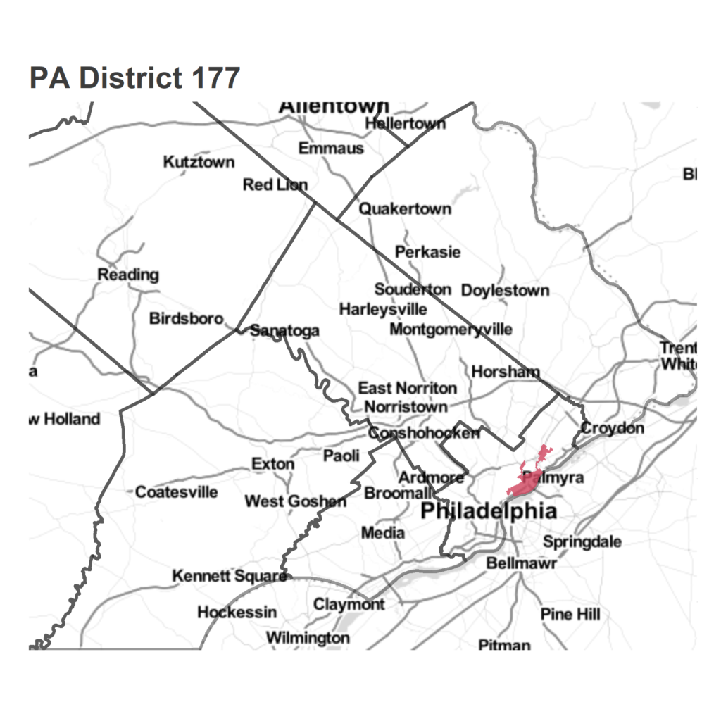
Today: Philadelphia’s PA House District 177
 |
 |
With Taylor stepping down, this race doesn’t have an incumbent for the first time in 34 years. Democrat Joe Hohenstein will be facing off against Republican Patty Kozlowski. Hohenstein challenged Taylor in 2016 and lost 55-45, and won a crowded Democratic Primary with a plurality of 37% of the vote. Kozlowski ran unopposed.
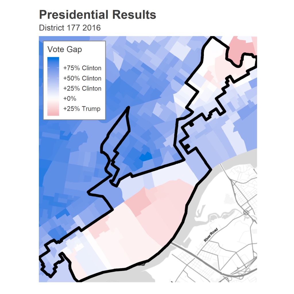
In 2016, Taylor beat Hohenstein by 10 points, even though Clinton beat Trump by 17 among the same voters. Taylor won 44 of the 71 divisions
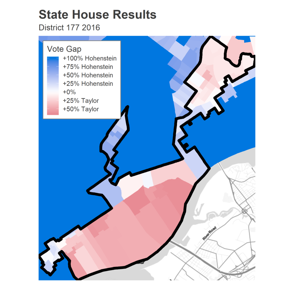
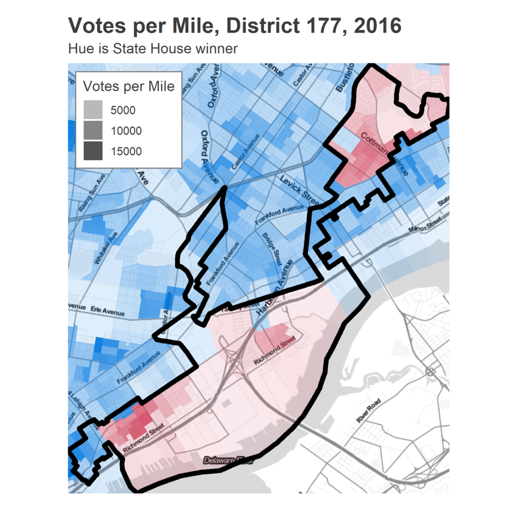
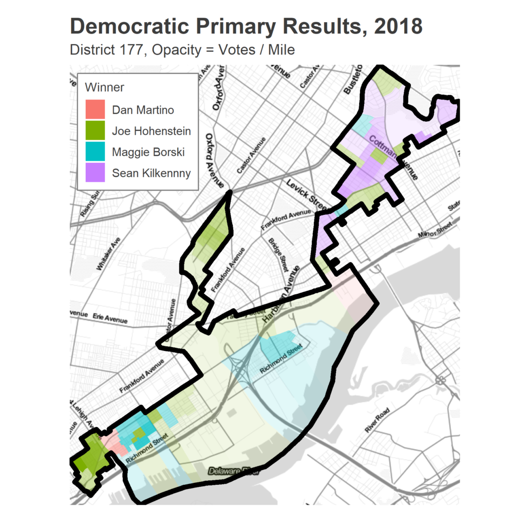
The spatial map can be a little misleading, as those divisions along the river are largely commercial/industrial, and have low population densities. A map of votes per mile shows the relative strengths of the districts.
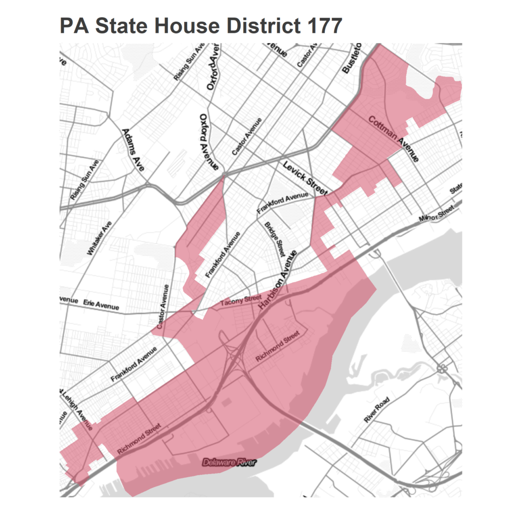
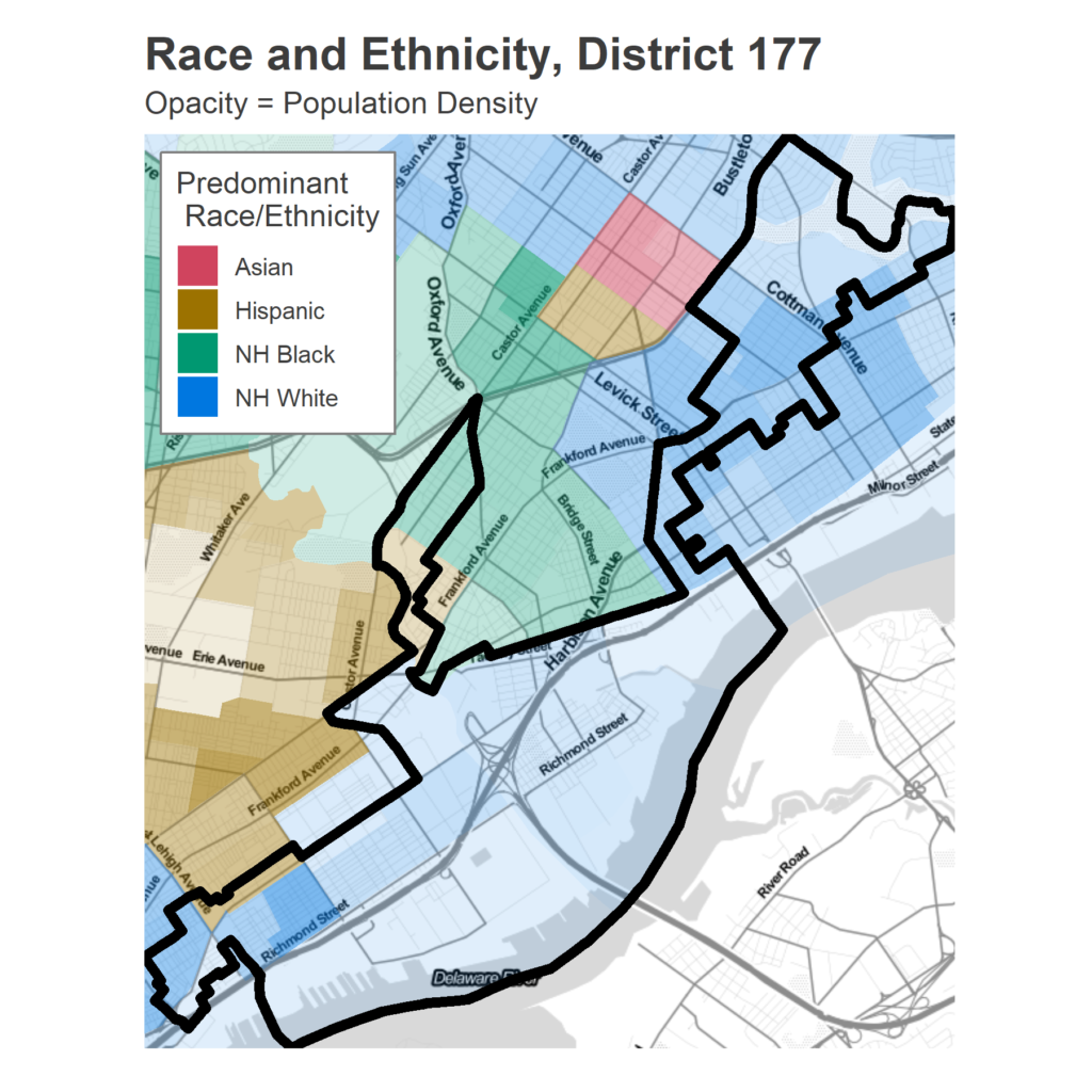
The district also manages to gerrymander out significant chunks of non-White Frankford. The one nub that ventures into predominantly Hispanic and Black neighborhoods along Castor Ave are also the divisions that voted the strongest for Hohenstein two years ago.
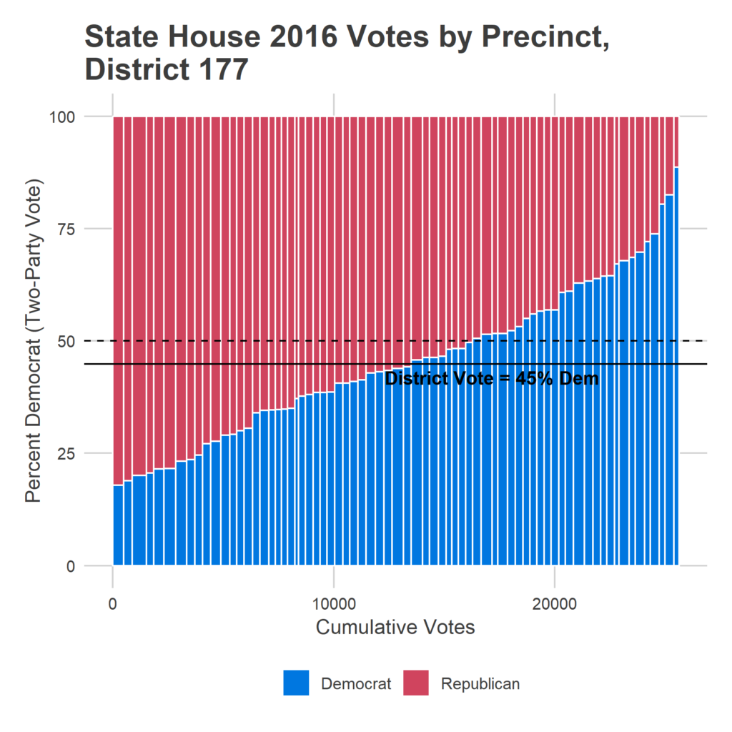
So how close is the race overall? The plot below lines up divisions by their 2016 percent Democrat, with widths denoting a division’s total votes. A ton of divisions sat between 40-50% Democrat in 2016, which would mean FiveThirtyEight’s 16 point swing towards the Democrats (an 8 percent increase in the vote) would easily put them over.
Presidential Results
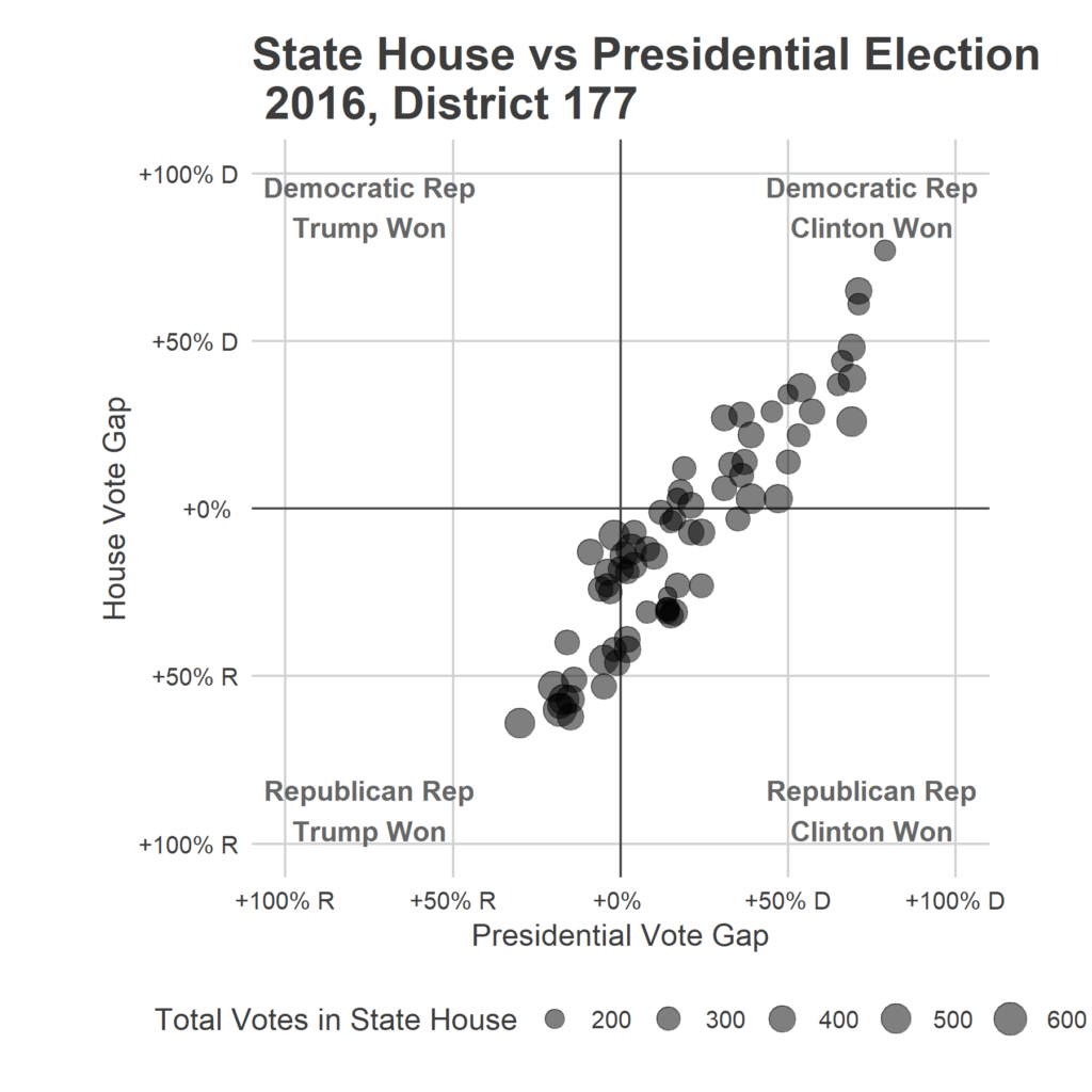
There are two huge good signs for Democrats: the retirement of Taylor, and how well Clinton did in 2016. She won by 17 points, even as Taylor carried the district. Every single division voted more strongly for Taylor than for Trump in 2016, indicating either favor for the incumbent or anti-Trumpism.
Turnout
A huge question in this district is going to be turnout. The district is extremely diverse, racially and politically, and the relative mobilization of precincts could determine who wins.
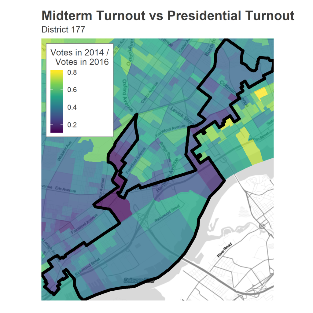
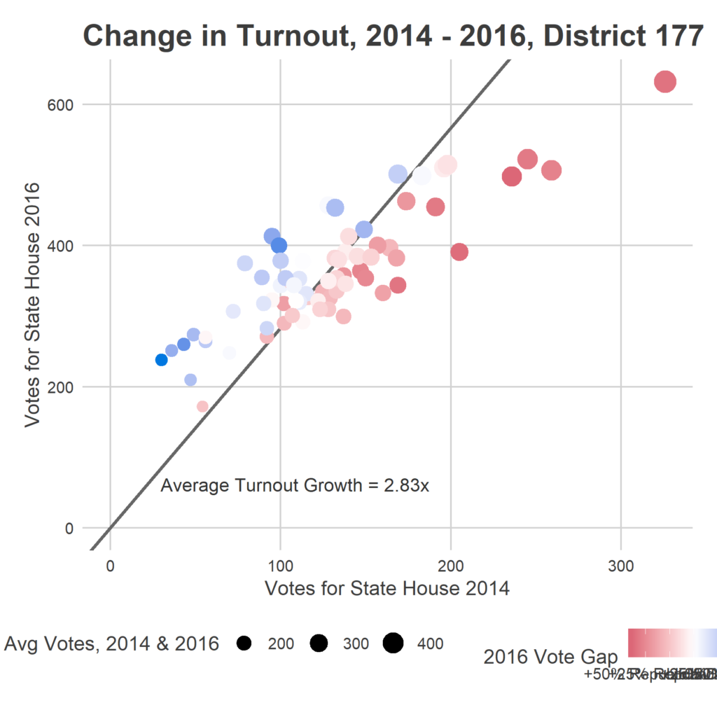
Turnout in the 2014 midterm was extremely weighted towards the Republican divisions. While the district as a whole saw 2.8 times as many voters in 2016 as in 2014, many Democratic divisions say *four times* the turnout. The heavily Republican divisions, because they turn out so strongly in midterms, had less relative growth.
Four years ago, only 13,237 people voted in the *general*, for the Governor’s race. It’s hard to figure out exactly what this means, since in 2014 this district didn’t even have a Democratic Primary, though it *did* have a Governor’s primary, with 2018 didn’t.
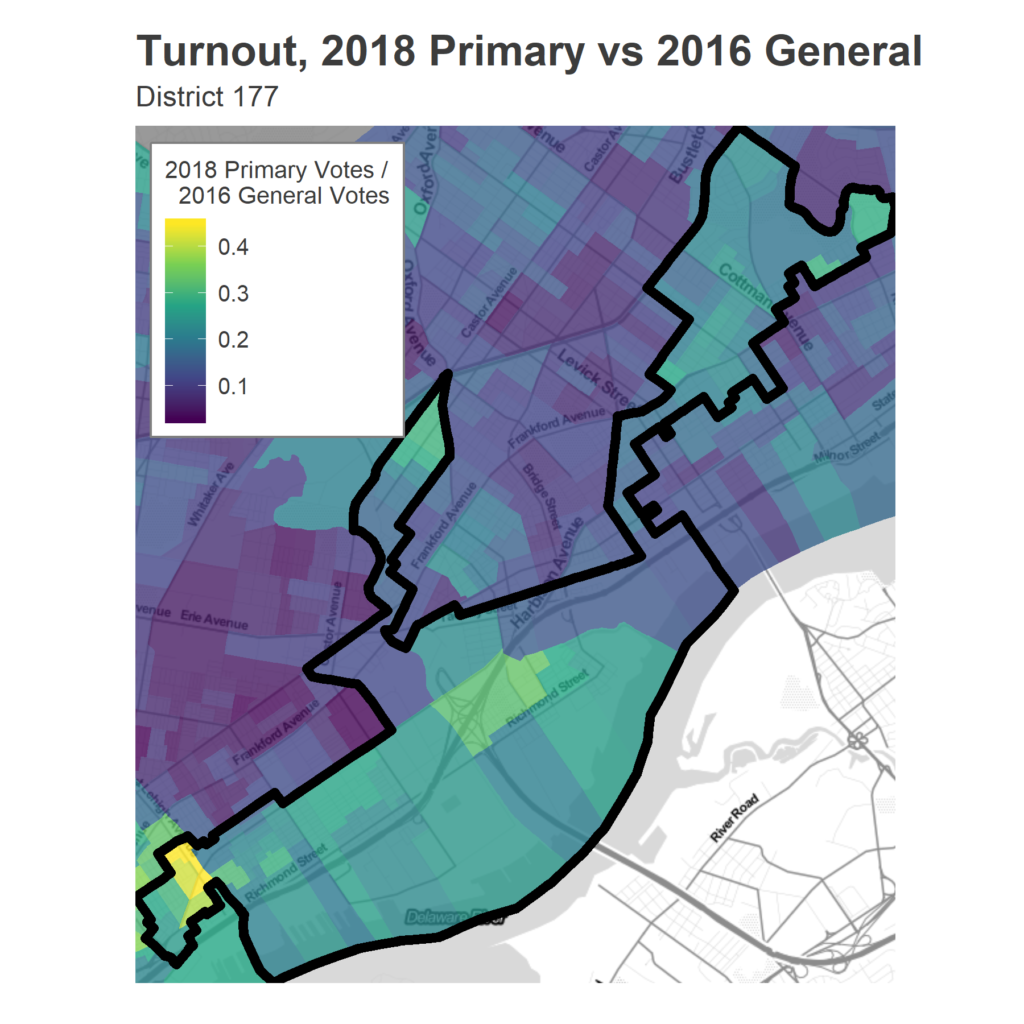
The map of Democratic turnout, though, is revelatory. The map belows shows votes in the May primary as a fraction of total votes in 2016. This gives a good measure of relative mobilization, assuming that the 2016 election represents a peak attainable turnout.
Election data from www.philadelphiavotes.com
Population data from the 2016 American Community Survey 5-year estimates.
Boundaries and GIS data from www.opendataphilly.org
Base maps provided by maps.stamen.com/
Updates: I’ve edited this article to reflect the fact that Representative Taylor lives in the Frankford arm of the district, explaining at least that part of its odd shape.